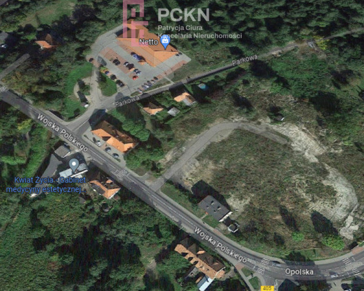
Niemodlin
- Total price
- 1 500 000 PLN
- Price m2
- 77,78 PLN
- Lot area
- 19 284 m2
- Lot area - unit
- m2
- Shape
- Varied
- Lot shape
- Irregular
- Lot destination
- Investment
- Electricity
- Yes
- Gas
- Yes
- Water intake
- Urban on a plot, Urban
- Sewerage type
- Urban
- Availability
- 2023-07-26
- Offer ID number
- 49/11485/OGS
Share
Description
I cordially invite you to familiarize yourself with the sale offer of a land property with a total area of 19284 m2 located in the center of Niemodlin.
A town in the Opolskie Voivodeship, in the Opole County, the seat of the urban-rural commune of Niemodlin. The Ścinawa Niemodlińska flows through the city, which flows into the Nysa Kłodzka near Lewin Brzeski.
A city with a well-developed service and commercial infrastructure, ideally connected with the neighboring voivodeship cities, thanks to the ring road connecting to the A4 motorway.
The presented land property is surrounded by green areas, a park and 100 m from the Castle Pond , which is located opposite the beautiful Niemodliński Castle . The pond is formed from the waters of the Ścinawka Niemodlińska River. The pond, which has undergone reclamation, has a walking path along the shore with large wooden sculptures. In the middle of the pond there is a restaurant "On the island".
The subject of the sale are charming areas intended for: MW - multi-family housing and ZN - low greenery.
1MW, U-multi-family housing development, service development areas, area 10259m2
MW – it means areas of high-intensity multi-family housing with built-in services. The height of newly constructed buildings and modernized buildings should not exceed five storeys above ground and must refer to the neighboring buildings. It is allowed to locate services that are not inconvenient on the ground floor and on the upper floors of buildings, provided that separate entrance zones are created. The location of playgrounds, sports fields and recreation and leisure facilities is allowed.
For newly designed areas in local plans, the following parameters and urban indicators are established:
1) the minimum share of biologically active area in a building plot is 40%,
2) parking space indicator min. 1 place for 1 residential unit plus additional places for the service function - to be determined in the local plan,
3) maximum development intensity 0.6,
4) the maximum building height in meters and the number of storeys in the city 15/5,
ZN-low green, area 9025m2
The basic purpose is low greenery in the form of lawns, meadows, pastures, single shrubs and their clusters, etc. and single trees or clusters of trees that are not forests. It is allowed to designate hiking, cycling and horse trails along with accompanying devices, field roads and forest tracks in consultation with the area managers.
I heartily recommend this investment area, giving the opportunity to implement a modern residential and commercial estate surrounded by unique natural areas.
Other info
- Overall height: 15
- Perccent of possible development: 60
- Local plan: Study of zoning directions and conditions
- Zoning plan: Multi-family housing, Service, Green areas
- Possibility of dividing: Yes
- Available neighborhood: Forest, Restaurant, Low building, Bazaar, Shop, Park, Pharmacy, School, Kindergarten, River
- Driveway type: Asphalt
- Communication: Bus


